
Map Shelby ZIP Code Coverage
Three postal ZIP codes appear in the core Shelby context: 28150, 28151, and 28152. They are postal coverage records, not a map of city neighborhoods. The North Carolina Department of Revenue table and USPS sources establish the postal-community association, but the research did not locate a published street-by-street boundary for any of the three. Verify a particular delivery address through USPS before treating a ZIP result as current and address specific.
| ZIP | Areas served or postal community | Post office | Boundary note |
|---|---|---|---|
| 28150 | Shelby postal community and core Shelby mailing area | USPS Shelby, NC 28150 postal organization | North Carolina lists both Cleveland and Rutherford counties; exact affected streets were not published. |
| 28151 | Shelby postal community | USPS Shelby postal organization | Listed with Cleveland County; precise city-limit, station, and neighborhood edges were not located. |
| 28152 | Shelby postal community | USPS Shelby postal organization | Listed with Cleveland County; confirm suburban, rural, and municipal edges through USPS. |
The North Carolina ZIP and county table is especially helpful because it makes the 28150 county crossover visible. It is not proof that every address using that ZIP sits inside Shelby or even inside Cleveland County. No source reviewed established a ZIP-only population total, voter total, realignment history, PO-box-only ZIP, or unique institution ZIP for Shelby, so none should be assumed.
Check Shelby ZIP Code Delivery
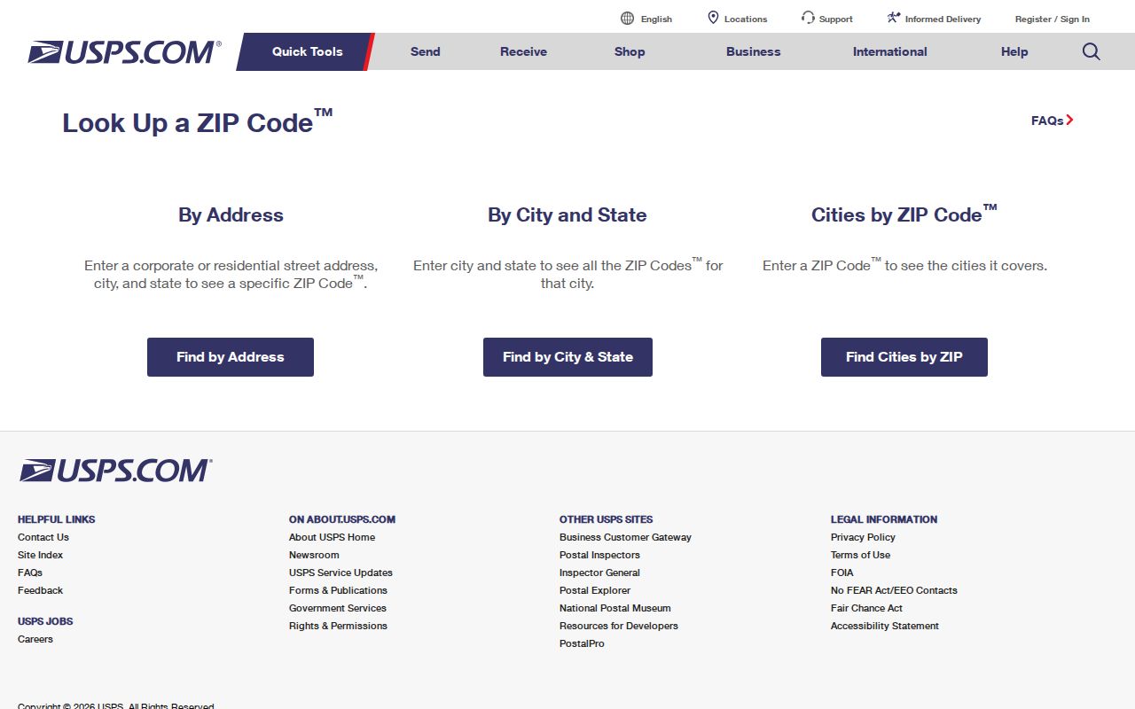
USPS is the final delivery check for a complete Shelby address. The public USPS ZIP Code Lookup can start with an address to find a ZIP or with a ZIP to identify or validate a postal community. The companion AIS service can retrieve, view, and print current ZIP and address information for all states. The unattended research did not capture a live Shelby street result, so use the current result rather than copying a generic ZIP description onto a particular property.
| USPS lookup field | Input type | Use for a Shelby ZIP code check |
|---|---|---|
| Enter address | Address text | Find the ZIP for a complete street address; live subfields can change. |
| Enter ZIP Code | Text | Identify a postal community or validate a ZIP. |
| City | Text or dropdown | Pair with the state when checking the city and ZIP relationship. |
| State | Dropdown | Select North Carolina for a Shelby query. |
| ZIP Lookup or Search | Button | Runs the dynamic USPS query. |
| AIS view or search | Service mode | Retrieves current address and ZIP information; exact filters were not exposed in the capture. |
USPS ZIP Code Lookup is the source shown below for a Shelby ZIP code directory delivery check.
A USPS result settles the current delivery question. It does not decide a parcel’s owner, municipal jurisdiction, or historical address form, which require separate records.
Note: Keep the USPS result date with the address because postal assignments and local address information can change.
Shelby ZIP Code Search Steps
Finding people or property within a Shelby ZIP code requires more than filtering a single directory. USPS validates the address and postal community. County mapping supplies parcel attributes and geometry. The public voter form does not offer a general ZIP browse. Historical sources use the address as printed in their own time. This sequence keeps the search within the limits of each custodian.
- Normalize the complete address with USPS lookup or the state AddressNC service, retaining ZIP+4 when it is supplied.
- Compare the USPS postal community with Cleveland WebGIS city, state, ZIP, PID, and parcel geometry, then check the city-limits or ETJ layer.
- Query or export county parcel attributes only if the live service allows a ZIP or address condition. Review each parcel’s situs and tax mailing values separately.
- For a registration question, search the official voter form by name and county or request a lawful county or precinct file. Do not assume a public ZIP filter exists.
- For an older address, compare directory, telephone-book, newspaper, deed, and map forms before applying a present-day postal code.
After a ZIP has narrowed the area, the Shelby street directory provides the address-by-address parcel and deed trail. A ZIP label is a helpful first slice, while a PID and legal description provide the stronger property handoff.
Shelby ZIP Code Parcel Fields
Cleveland County WebGIS parcel metadata includes city, state, ZIP, GIS PID, map, owner fields, deed book and page, physical address, tax mailing address, values, acres, description, neighborhood, tax district, and tax year. The city’s EnerGov address metadata also includes a ZIP field along with street, floor, land-use, address-verification, and question flags. Those fields make a ZIP code useful for organizing a parcel query, but the research did not verify a stable public ZIP-wide search mode in WebGIS.
Use the live viewer’s address or parcel search first, then add an available ZIP, municipality, tax-year, or parcel condition only if the interface exposes it. County ArcGIS service fields can support a query or export where enabled. The WebGIS public map is not a survey, and its owner or tax mailing field is not a complete resident record. A postal city can differ from the situs address and from the county that assesses the parcel.
Shelby ZIP Code Voter Limits
The official NC Voter Search is a name-first tool. It asks for first and last name, with optional middle initial, birth year, and county, plus registration status. It does not supply a simple public Shelby ZIP code directory. A lawful county or precinct list request may be selective by precinct, registration date, district, voter history, and other reasonable categories under G.S. 163-82.10, but its available fields, format, cost, and privacy limits are controlled by the elections custodian.
Public-list rules protect full dates of birth, Social Security information, driver-license information, emails, ID and photo copies, and qualifying protected addresses. Voter history records election participation, not ballot choice. Use the North Carolina Voter Search for an individual name-and-county question and contact the Cleveland County Board of Elections for a properly scoped existing-record request.
Shelby ZIP Code City Limits
ZIP boundaries and Shelby city limits are different systems. A ZIP is a postal delivery geography. City limits define municipal jurisdiction, and the ETJ is an extraterritorial planning area. County tax records use their own assessment jurisdiction. Shelby’s planning GIS publishes separate layers for city limits, ETJ, county boundary, adjacent counties, streets, and parcels. The city also maps labels such as Uptown, West Warren Historic District, East Marion/Belvedere Park, wards, and zoning, but no simple official neighborhood-boundary table was located.
The 28150 Cleveland and Rutherford county crossover is the local example of why postal and government boundaries cannot be merged. Compare the USPS result, county parcel geometry, county value, and city layer before making a jurisdiction statement. A Shelby mailing address can be in unincorporated county land or the ETJ. That is a records-geography issue, not an error in the postal address.
- ZIP code
- A USPS delivery code for a postal community or route. It does not define a city boundary or property line.
- ZIP+4
- An added four-digit delivery detail attached to the base ZIP. Preserve it when USPS supplies it for the complete address.
- PO-box ZIP
- A ZIP assigned for post-office-box delivery. No Shelby PO-box-only ZIP was verified in the research, so ask USPS about a specific box.
- Unique ZIP
- A ZIP used by one organization or location. No Shelby unique ZIP was verified in the source set.
- Carrier route
- A mail-delivery grouping used by USPS. It is not a resident roster or municipal boundary.
Shelby ZIP Code Address Types
Label every Shelby result by the kind of address it contains. A situs address is the physical parcel. A tax mailing address is where assessment notices are sent. A directory or filing address records an occupant, business, agent, or past moment. The fourth check is spatial: compare city limits or ETJ with the postal ZIP. This address-status discipline prevents an owner field from becoming a resident claim, a mailing city from becoming a municipal boundary, or an old directory line from becoming a current fact.
The state AddressNC geocoder can normalize an address string before county GIS research. Its fields include address components, neighborhood, city, county, state, postal code, postal extension, and address-change information. It is an addressing reference, not proof that a person lives at the address. Use a deed’s legal description and a parcel PID when the street number is incomplete or has changed.
Shelby ZIP Code History Clues
Older Shelby sources may omit a ZIP code or use an address form that no longer matches the current delivery result. Preserve the line exactly as printed, including direction, suffix, lot or block, and post-office town. Then compare it with a deed, plat, Sanborn map, newspaper, or directory. Do not back-project a current ZIP onto a 1930s directory entry without evidence.
The North Carolina Room maintains city directories, telephone books, Shelby Star microfilm, deeds, tax lists, historic maps, and local files. Shelby Sanborn maps are available for 1885 through 1921 at the Cleveland County Archive, and the Library of Congress catalog describes an April 1926, 22-sheet set. A map can show a building footprint, block, alley, street context, and land use. It does not name every occupant. Those sources make a postal-history search more accurate without turning a historical line into a present-day location claim.
Shelby ZIP Code Request Routes
Use the custodian that holds the existing record. USPS online lookup and AIS handle delivery validation, with a local postal contact route for an ambiguous address. Cleveland WebGIS and county ArcGIS handle parcel ZIP, city, tax district, and geometry. City planning GIS handles city limits, ETJ, address flags, planning layers, and permits. The Register of Deeds handles legal descriptions that survive a street-number change. Library directories, maps, and newspapers supply historical address forms.
For an existing county or city address list or GIS export that is not online, a written request can name the record, custodian, fields, date range, and preferred format. Under Chapter 132, the agency need not calculate a new historical ZIP-boundary study or create a new directory. The practical request is narrow: ask for an existing export with ZIP and jurisdiction fields, then compare the output to the postal result and parcel geometry. That preserves the useful distinction between postal coverage and public-record boundaries.
Note: A narrow request for an existing record is more likely to reach the correct custodian than a request to build a new ZIP list.