
Shelby Neighbors Block Sources
A block search has several layers. Cleveland County WebGIS supplies parcel geometry and owner-related tax fields. The Register of Deeds confirms a recorded title trail. City planning layers can add zoning, permit, ward, historic-district, code-division, and ETJ context. Voter information follows its own public-list rules. Library directories and maps describe earlier people and buildings, not present occupants. Keeping those layers separate is the clearest way to learn about nearby parcels without treating one data point as a full household list.
| Block source | What it can show around an address | Access and limit |
|---|---|---|
| WebGIS parcels and Adjoiners | Touching-parcel geometry, PID, owner fields, values, deed reference, and districts | Free viewer with Adjoiners, buffer, Identify, and export tools. |
| Register of Deeds | Title transfer, shared plat or lot references, grantor, grantee, book/page, and date | Online index plus counter route; older index limits apply. |
| City planning GIS | Permits, zoning, wards, historic districts, ETJ, code divisions, and planning context | Public layers have different date ranges and do not create a person index. |
| Voter search or list request | Permitted registration, precinct, district, and voter-history fields | Name-first lookup or requested list; protected fields and addresses stay protected. |
| Library directories and maps | Historical occupants, business and phone clues, block footprints, and street context | North Carolina Room, microfilm, selected scans, archive, and map catalogs. |
Owners and occupants are different categories. Parcel fields may list a title or tax name, while a tax mailing address may point elsewhere. A voter record is a registration record, not a map of every address. A city permit can identify an applicant or contractor and a project date, but it is not a resident roster. Those limits matter most when the address is near the city edge or a corner shared by several parcels.
Note: Record the PID, search date, selected layers, and map method so the same Shelby neighbor set can be checked later.
Shelby Block Adjoiner Search
Cleveland County WebGIS provides the practical starting point for a tight block. Search an address, street fragment, owner name, or PID. WebGIS help recommends using less text when a street spelling or format is uncertain. Open the target parcel, turn on parcel boundaries and relevant planning or district layers, then use the Adjoiners tool to select parcels sharing a line or corner. If Adjoiners is unavailable in the live view, the Identify tool can inspect adjoining parcels through point, rectangle, polygon, or multipoint selection.
Cleveland County's parcel-service metadata documents the owner, deed, situs, mailing-address, and value fields used for a Shelby parcel search.
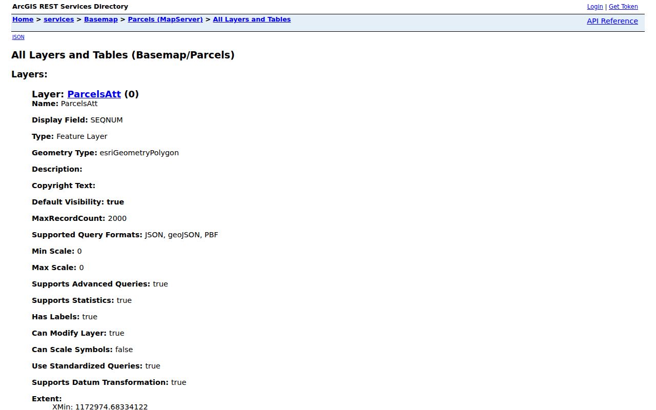
These fields support a parcel-based method. They do not supply a list of nonowner household members or utility customers.
- Locate the target address or PID in WebGIS and save the displayed parcel identifier.
- Use Layers to show parcels and any needed city, district, or planning context. Inspect the legend and scale limits before relying on a layer.
- Select Adjoiners for parcels sharing a boundary or corner. Use Select by Buffer for a small measured area when the goal is an immediate radius.
- Sort the Results table and open each selected parcel. Capture PID, owner, situs, tax mailing address, deed reference, tax district, and description.
- Confirm the title question through the Register of Deeds. For a full street-by-street chain, use the Shelby street directory instead of expanding a neighbor search without limit.
Note: Treat the buffer distance as a search setting, not a survey measurement or a legal boundary.
Shelby Parcel Record Labels
Nearby parcels can look closer on a map than they are in the record system. Label every address result before comparing it. The situs address is the physical parcel. The tax mailing address is where assessment notices go. A legal description or deed book/page identifies the title instrument and may survive a street-number change. A historical directory or filing address may belong to an earlier time, a business, or an agent. None should be silently substituted for another.
- PID
- The county parcel identifier. It is the most stable handoff from WebGIS to Parcel History, a property card, and related map views.
- Situs address
- The physical location assigned to the parcel. It is useful for mapping but does not name every person there.
- Tax mailing address
- The address where tax material is sent. It may differ from the parcel and is not evidence of occupancy.
- Adjoiner
- A parcel sharing a common line or corner with the target. A corner contact, alley, or right-of-way can change what the map selection means.
Parcel geography has a second check: city limits, ETJ, tax jurisdiction, and postal community are separate layers. Shelby's planning GIS identifies areas such as Uptown, West Warren Historic District, East Marion/Belvedere Park, wards, municipal district, and Shelby ETJ. A Shelby mailing address alone does not prove that a lot lies in the city. Compare the city ETJ layer and county parcel data before describing a block as inside Shelby.
Shelby Voter Record Rules
A voter layer can help with a civic question, but it is not a substitute for parcel geometry. The public Voter Search is name-first. Under G.S. 163-82.10, a requested county or precinct list can include specified registration fields and be selective by precinct, registration date, district, voter history, and other reasonable categories. A request for a magnetic-medium list can include actual medium cost and up to a $25 service charge.
Voter history indicates participation, not ballot choice. Full date of birth, Social Security data, driver-license information, email, identification copies, and qualifying protected addresses are confidential. The current Cleveland County Board of Elections page says the office moved to 827 West Marion Street in Shelby, while older county material uses a different address. Confirm the route with the board before an in-person visit. A missing address should never be treated as proof of protected status.
The useful block workflow is narrow: identify the relevant precinct or parcel context, ask for an existing lawful public record if necessary, and retain the format, date, and fields requested. Do not ask an office to create a new neighbor profile. The North Carolina Room and State Archives are the better channels for historical voter materials when a current registration result cannot answer a dated question.
Shelby Civic Record Contacts
No official Shelby neighborhood-association, HOA, block-watch, congregation, or member-roster directory was located in the research. The public community layer that is available is the City's Boards & Commissions inventory. It lists civic bodies and an application route, not a map of nearby residents. A public agenda or application can show civic participation when the item is public, but it does not establish that an applicant lives on the adjacent block.
Shelby's Boards & Commissions page is shown below because it is the closest official civic-directory source found for the immediate block.
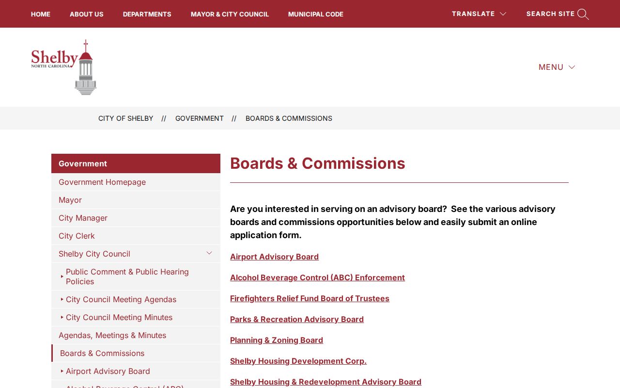
The listing offers public board names and applications, rather than private neighborhood membership information.
City Boards & Commissions
Public application and board route for Airport Advisory Board, Alcohol Beverage Control Enforcement, Firefighters Relief Fund Board of Trustees, Parks & Recreation Advisory Board, Planning & Zoning Board, Shelby redevelopment bodies, Shelby Public Art Advisory Board, and Zoning Board of Adjustment.
City Clerk
The City Clerk's office is the custodian for city files, council proceedings, meeting materials, ordinances, and public-record request routing.
Planning and Development
Planning and Development Services handles planning, zoning, building, and code routes. Its records are address and project evidence, not a current-neighbor list.
Shelby Deed Record References
When several parcels share a subdivision, lot, or plat reference, the next step is title confirmation. WebGIS parcel metadata can expose a deed book/page and related parcel fields. Search the recorded owner as grantee around the transaction date in the Cleveland County Register of Deeds land-record route. Then inspect the instrument or ask the office whether an image is online, office-only, or unavailable.
The online real-property index is verified from January 3, 1995 forward. The 1945 through 1994 Consolidated Index is expressly unverified, and red results are finding aids rather than confirmed title evidence. For 1979 through 1985, the documented search is by name and year, so the instrument must supply the exact date. Older deeds may require book/page lookup, office books, microfilm, or a counter request. This is why a full street search should not be reduced to a modern address string.
For an immediate block, retain each result by parcel rather than grouping people together. If two owner fields are shown, preserve both. If the mailing city differs from Shelby, retain the original value. A shared plat can explain lot relationships, while the deed establishes a title trail. Neither document identifies every current neighbor.
Note: Red pre-1995 index results need office verification before they are treated as a confirmed transfer of title.
Shelby Block History Layers
Historical block work needs a different set of records. The North Carolina Room lists city directories, telephone books, Shelby Star microfilm, maps, tax lists, voter records, cemetery surveys, yearbooks, and family files. A directory entry or newspaper notice is a time-stamped clue, not a current residency claim. The room's collection and controlled handling rules make it a stronger route for a former block question than a current parcel screen alone.
The Cleveland County Archive holds Shelby Sanborn material from 1885 through 1921, while the Library of Congress catalog identifies an April 1926 Shelby set with 22 sheets. A Sanborn map can show a building footprint, use, adjoining street, alley, and lot context. Pair it with a deed plat and modern GIS before matching an old printed address to a current parcel. That extra geography check is valuable where historic district, ETJ, city, and postal boundaries do not align.
For a historical community connection, name the collection and year with the result. The library's city-directory shelf has selected documented runs and a 1943/44 DigitalNC volume, but an exhaustive reverse-directory inventory was not confirmed. Ask the North Carolina Room for the exact volume and format rather than assuming a street section exists.
Shelby Records Tool Comparison
Official records and commercial neighbor tools serve different purposes. County and city sources make it possible to inspect a custodian's field, date, and access limit. Commercial people-data products may combine public filings, marketing data, and address histories, then present a broad list that can be old or attach a similar name to the wrong person. Use any such result only as a prompt to check the responsible public custodian.
| Official record route | Commercial neighbor category |
|---|---|
| Identifies its custodian, source field, date, and legal access rule. | Can combine data from varied sources with different update dates and unknown matching methods. |
| WebGIS separates parcel, owner, situs, tax mailing, and deed information. | May collapse those different labels into one address history. |
| Corrections go to the Register of Deeds, GIS office, Board of Elections, Clerk, or other originator. | Removal or correction follows the provider's own privacy or opt-out process and does not change an official record. |
When an official result is unclear, preserve its record identifier and ask the named custodian about the original field, date, or correction route.
Note: A broad compiled result should never replace a parcel, deed, voter, or civic record checked at its source.
Shelby Record Privacy Limits
Parcel work does not reveal every person on a block. It does not provide a public list of renters, other household members, guests, utility customers, or delivery recipients. Protected voter addresses and Address Confidentiality Program information must not be reverse-engineered through nearby parcels or past records. Court seals, restricted vital records, and confidential identification data are legal limits. North Carolina's public-record access rules do not erase those limits.
Lawful use. Shelby block records are for personal, lawful research, neighborhood curiosity, and civic context. Never use them to watch, stalk, harass, threaten, or intimidate another person.
If a parcel, title, map, or voter record appears inaccurate, ask the originating custodian about correction. Preserve the PID, deed book/page, case number, or other record identifier. For an immediate safety threat, contact emergency services or local law enforcement rather than relying on a portal result. Public data can lag and should never replace a direct safety response.